Tutorial 1 of 6
Speedometer, trip log and walk-to-measure distance
Beginner 8 min
Use your phone as a speedometer with trip log and GPX download, and measure a distance by walking it.
Pocketlab turns the sensors of your phone or tablet into measuring instruments. This tutorial covers the two GPS instruments: the Speedometer with its trip log and Distance & position, which measures a distance by walking it.
Nothing starts on its own. Every instrument has a Start button, and the browser asks for permission the first time (location for the GPS instruments). Positions stay in your browser tab and are never uploaded. Switching to another instrument stops the GPS.
On a phone you can bookmark pocketlab.usefulweb.site/app#instrument=speed (or #instrument=distance) to jump straight in. Old Ohmforge bookmarks such as /app#pocket=speed open the same instrument here.
Speedometer and trip log
- Go outside, choose Speedometer in the instrument list and press Start trip. The first GPS fix can take a few seconds.
- The big number is your current speed. Choose km/h, mph, m/s or knots under Speed unit; the notebook remembers it.
- Pause stops counting, for example at a café. Resume starts a new track segment, so the pause adds time but no distance.
- Stop ends the trip. Download GPX saves it as a standard GPX 1.1 file that sports apps and map tools can open.
Below the speed you see distance, moving and total time, average and moving average, maximum speed, climb, the GPS accuracy, your position and the GPS height, plus a speed-over-time chart. Fixes less accurate than ±30 m are skipped.
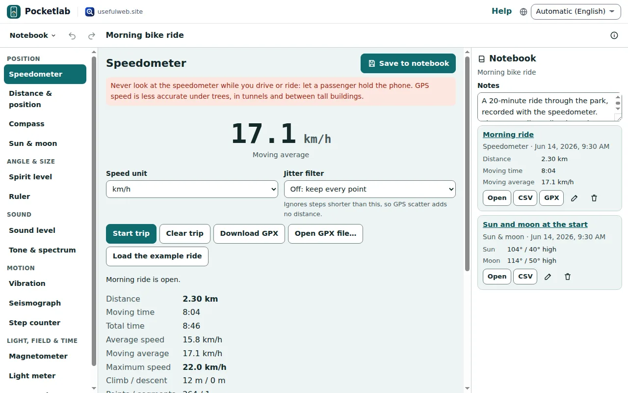
When you walk slowly or stand, GPS positions scatter by a few metres and add distance that you never walked. Set Jitter filter to 5 m or 10 m: steps shorter than that are ignored.
Safety: never look at the speedometer while you drive or ride. Let a passenger hold the phone, or look at the trip afterwards.
Open a GPX file or the example ride
Open GPX file… reads a track from a bike computer, a sports watch or another app and shows the same statistics. Load the example ride opens a 2.3 km ride so you can try everything on a computer.
The numbers come from the same engine as the ohmforge-gps-trip-stats tool, so the trip you record and the GPX file you download give exactly the same result there.
Save the trip to the notebook
Press Save to notebook (or Ctrl+Enter). The trip appears in the Notebook column with its distance, moving time and average. From there you can reopen it in the speedometer, download it as CSV or GPX, rename it or delete it. The tutorial The measurement notebook shows all of that.
Walk-to-measure distance
Distance & position measures how far apart two points are — the length of a garden, a field or a car park.
- Press Start GPS and wait until the accuracy drops to a few metres.
- Stand at the start and press Mark start here.
- Walk to the end point and press Mark end here.
The big number is the straight-line distance between the two marks. Walked distance follows your path. Uncertainty adds up the GPS accuracy at both ends: GPS scatters by a few metres, so distances under about 20 m are rough.
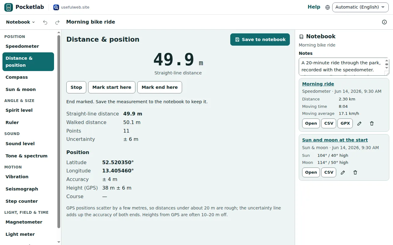
The Position block shows latitude, longitude, accuracy, the GPS height and your course. GPS heights are often 10–20 m off; use them to compare, not as a survey.
Ready to try it?